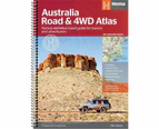
Hema Australia Road and 4WD Atlas - Edition 13 (Spiral Bound B4 Size)

This brand-new edition features 187 updated map pages in a stunning new cartographic style. Every atlas in the range includes maps for 4WD and touring destinations such as Cape York, Fraser Island, the Top End, the Kimberley, the Pilbara, Central Australia, High Country Victoria, and the Flinders Ranges. Additional maps also provide more detailed coverage for the country's busy coastal strips. The atlas is still the ultimate resource for exploring Australia, featuring comprehensive Hema mapping that's filled with relevant touring information Pinpointed on the maps are caravan parks, camping and rest areas, fuel locations, accredited information centres and points of interest. A handy distance grid, national park guide, list of accredited information centres and a complex index are also included to assist with trip planning and navigation.
Features:
- Detailed 4WD tracks
- Fuel
- Points of interest
- National parks
- Campsites
- Caravan parks
- Rest areas
- Road distances
- Fully indexed
Product Details:
Edition: 13
Media: Spiral Bound
Pages: 210
Weight: 1.5 kg
Length: 34.5 cm
Width: 25.2 cm
Publication Date: 01/01/2022