Garmin GPSMAP 65 Handheld GPS w TOPO Maps


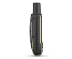


Garmin GPSMAP 65 Handheld GPS
(Garmin 0100245102)
We think YOU should know
- Supplied with Garmin TOPO Maps - Australia & NZ (010-C1049-00)
- Multi-Band GNSS Support
- Preloaded AU&NZ TOPO Maps
- Smart Notifications
- MicroSD Slot
OVERVIEW
Explore more with this rugged handheld that offers multiple frequencies for our most accurate position to date, a 2.6" color display and preloaded maps.
Physical & Performance Physical dimensions 6.1 x 16.0 x 3.6 cm GPS Yes High-sensitivity receiver Yes Interface High-speed mini USB and NMEA 0183 compatible Display size 3.6 x 5.5 cm; 2.6-inch diagonal (6.6 cm) Water rating IPX7 Display resolution 160 x 240 pixels Weight 217 g with batteries Display type Transflective, 65K colour TFT Battery type 2 AA batteries (not included); NiMH or Lithium recommended Battery life 16 hours Maps & Navigation Waypoints/favorites/locations 5,000 Track log 10,000 points, 200 saved tracks Preloaded maps Yes (TopoActive; routable) External memory storage Yes (32 GB max microSD(TM) card) Routes 200, 250 points per route; 50 points auto routing Basemap Yes Memory/History 16 GB (user space varies based on included mapping) Ability to add maps Yes Features VIRB(R) Remote Yes Exchange locations with other inReach device No GLONASS Yes Location reporting (send and receive GPS positions) No GPS compass (while moving) Yes Send route selection to MapShare during trip No Sun and moon information Yes Compatible with Garmin Explore(TM) app Yes Send waypoints to MapShare during trip No Map segments 3,000 Point-to-point navigation Yes Automatic routing (turn by turn routing on roads) Yes LED beacon flashlight No Frequency band No Interactive SOS No Weather No Picture viewer Yes Garmin Explore website compatible Yes Rinex logging No Pairs with Garmin Connect(TM) Mobile Yes Compatible with BaseCamp(TM) Yes MapShare compatible with tracking No Dog tracking No Custom maps compatible yes (500 custom map tiles) Galileo Yes Tracks 200 VOX (voice activation) No Geocaching-friendly Yes (Paperless) BirdsEye 250 BirdsEye Imagery files Send and receive text messages to SMS and email No Includes searchable points of interests (parks, campgrounds, scenic lookouts and picnic sites) Yes inReach remote compatible No Includes detailed hydrographic features (coastlines, lake/river shorelines, wetlands and perennial and seasonal streams) Yes Displays national, state and local parks, forests, and wilderness areas Yes Compatible with Earthmate No Hunt/fish calendar Yes LiveTrack No Vibration alert No Active Weather No Connect IQ(TM) (downloadable watch faces, data fields, widgets and apps) No inReach remote widget No Wireless connectivity Yes - Bluetooth(R), ANT+(R) Touchscreen No Smart notifications on handheld Yes Send and receive text messages to other inReach device No Contacts No XERO(TM) Locations No MIL-STD-810 No Virtual keyboard for custom messaging No Compass No Area calculation Yes Barometric altimeter No
‘Don’t Pay’ is the recommended retail price provided by the supplier or obtained from the manufacturer, or is the recently advertised price for the same product on a different or competing online platform or store. Catch may not have previously sold the product at the ‘Don’t Pay’ price.